
Lot 3037
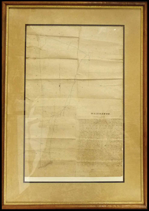
Hawaii, "Waikoekoe, Hamakua - Hawaii", original 13"x 20" hand-drawn map from the Great Mahele period by C. J. Lyons dated "Nov. 1853" and framed in beautiful koa wood, accompanied by two Documents Signed "C.J. Lyons" with one headed "Hela 9926 Luhi / Waikoekoe, Hamakua, Hawaii" and other "Helu 9927 Loua / Keaa, Hamakua, Hawaii", each with small land parcel drawings; some folds, F.-V.F.Estimate $1,000 - 1,500.
This map was found in a found in an archive of Davey’s Sugar Mill office locked away for over 75 years. C.J. Lyons was Hawaiian Assistant Surveyor under W.D. Alexander and the official surveyor of the Hamakua coast for the Mahele. He assisted in early triangulations on Maui and Hawaii, and later with meteorological problems initiating a Meteorological Service in 1900 and regular rainfall reports.